
The
Lancaster and District Birdwatching Society Recording Area
|
Newsletter of the Lancaster and District
Birdwatching Society |
|
|
The
Lancaster and District Birdwatching Society Recording Area
|
|
|
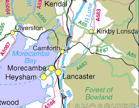
Note: In the NW of the area the recording area boundary traditionally stops at the River Winster, the southern boundary is at Lane Ends amenity car park, overlooking Pilling Sands.
Image produced from the Ordnance Survey Get-a-map service. Image reproduced with kind permission of Ordnance Survey and Multi Media Mapping.
A site by site map can be found on the LDBWS pages (click here)